INSURANCE

Property

Combining technologies and data analytics to provide a unique view of your global property portfolio

01 / PRE & POST EVENT ANALYSIS

Pre and Post Event Analysis

In addition to conventional property losses, the insurance sector faces the challenge of accommodating Climate Risk within its business model. Flood, Extreme Heat, Wildfires, Earthquakes, Hurricanes, Tsunamis. Tornadoes and Drought, unleashing potentially catastrophic events.

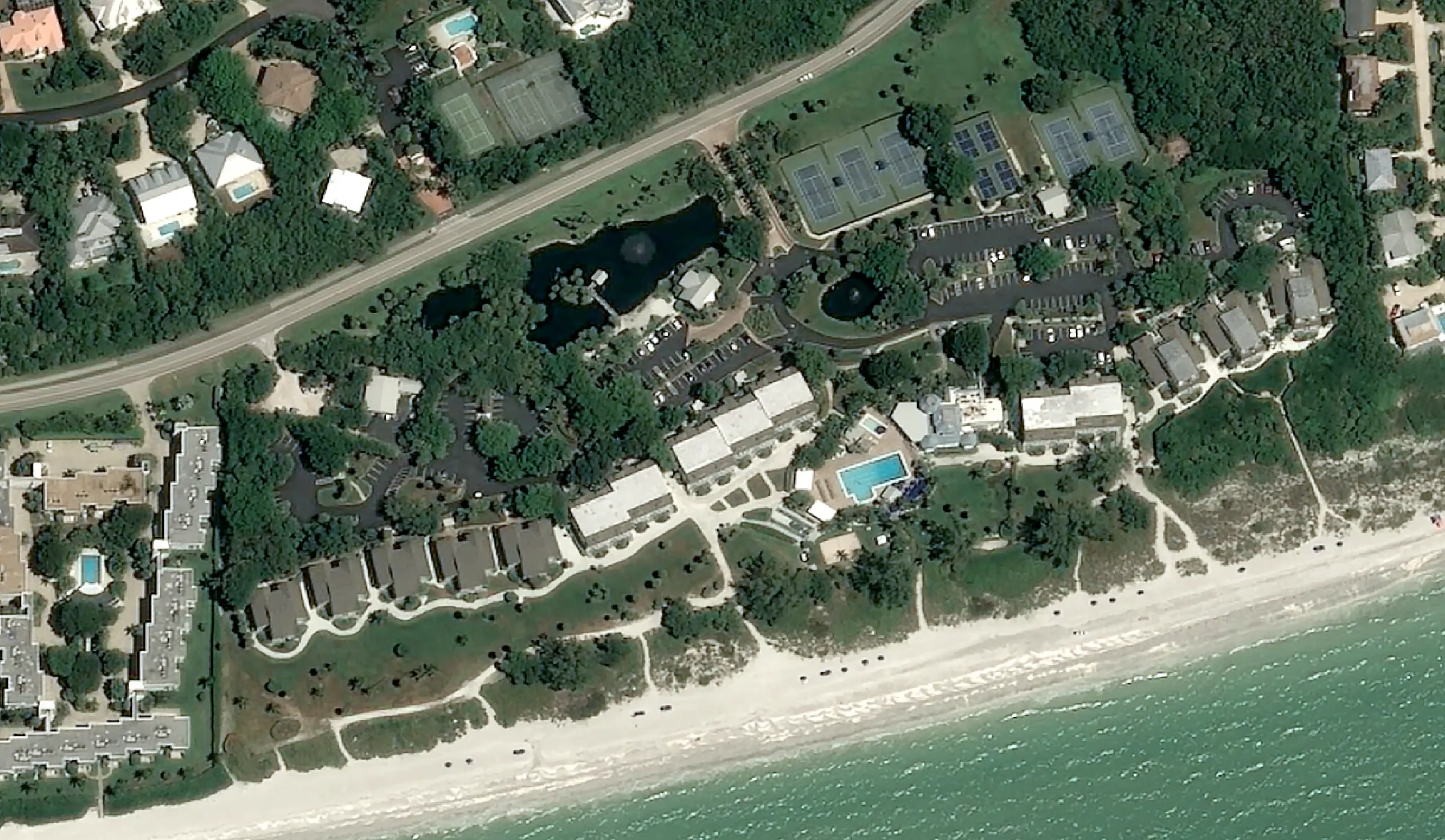
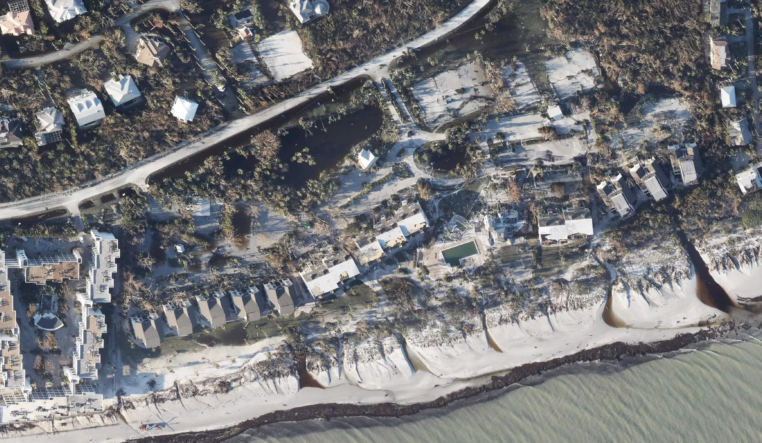
Using satellite imagery, we provide pre/post event analysis to assess the extent of damage, verify the accuracy of claims and identify potential fraud.
Flood

Wildfire

Hurricane

Earthquake

Drought

hurricane-ian-post001a hurricane-ian-post001b

Pre-Event Image: August 22nd, 2022 of the Casa Ybel Resort – Credits @AirbusSpace

Post-Event Image: September 30th, 2022 of the Casa Ybel Resort – Credits @ NOAA

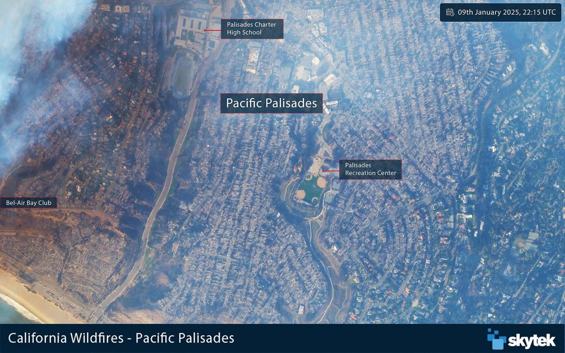
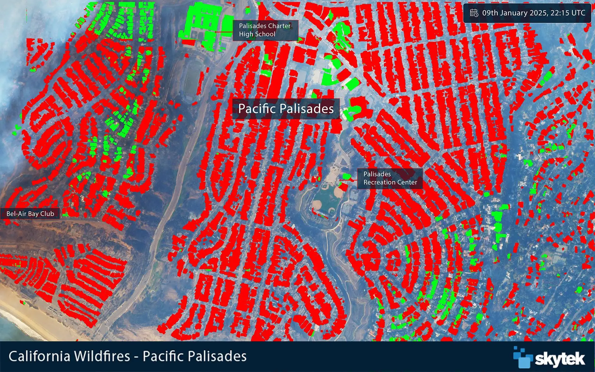
20250109-Palisades-EO 20250109-Palisades-EOML

PlanetLabs satellite imagery of Pacific Palisades on January 09th, 2025

PlanetLabs satellite imagery of Pacific Palisades on January 09th, 2025 overlaid with Skytek ML damage layer

02 / NATURAL CATASTROPHE

Natural Catastrophe Losses

Natural catastrophes, such as hurricanes and typhoons, can cause extensive property damage and destruction. These catastrophic events result in claims which cost the (re)insurance market billions of dollars each year.

Due to the scale of damage caused, it can often take many months to get an accurate estimate of the total cost. Our Satellite Club solution quickly and accurately estimates the level of damage to residential properties in a region after a natural catastrophe.

03 / RISK AGGREGATION

Risk Aggrehgation

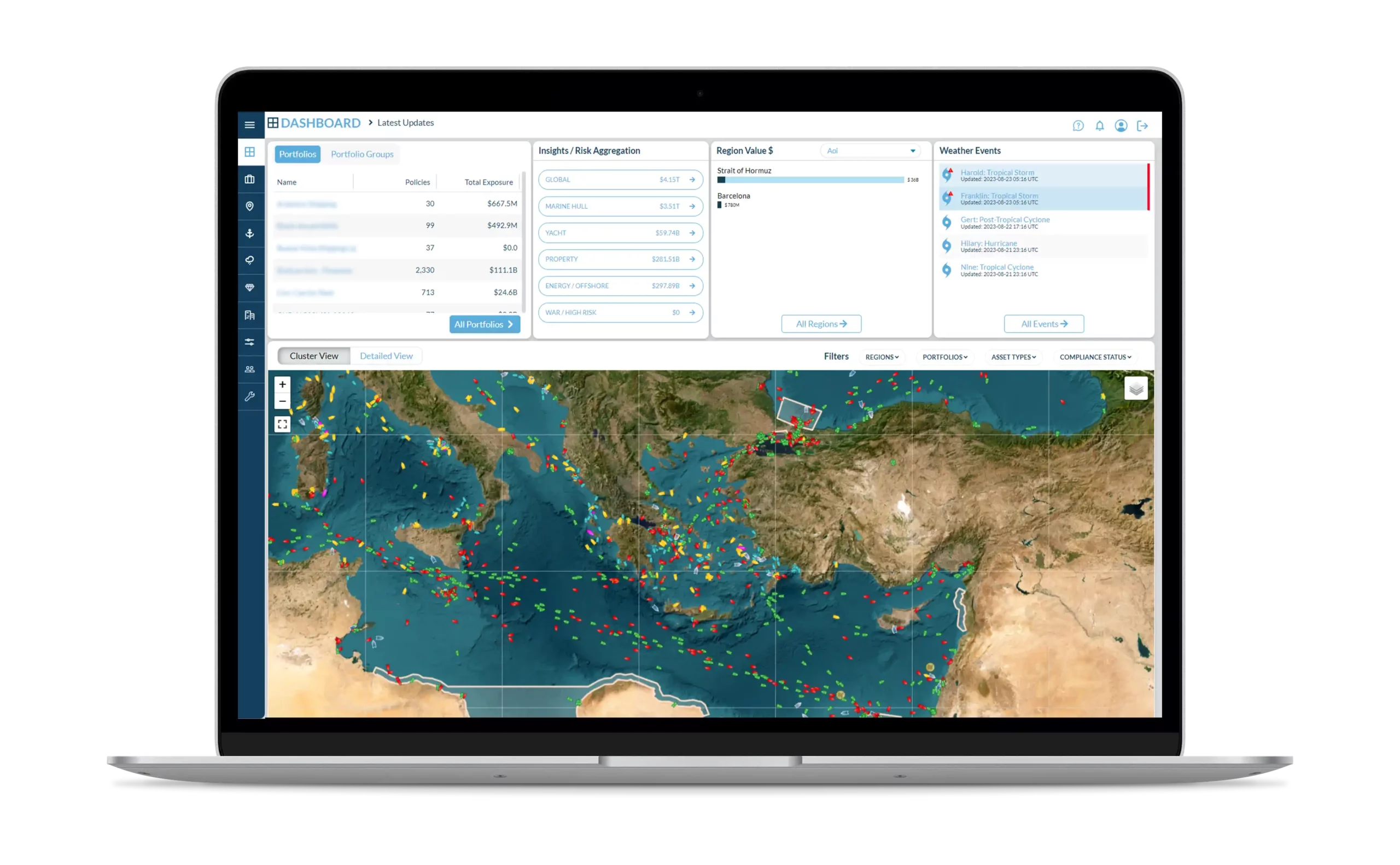
Track all fixed and mobile insurable assets on one platform.

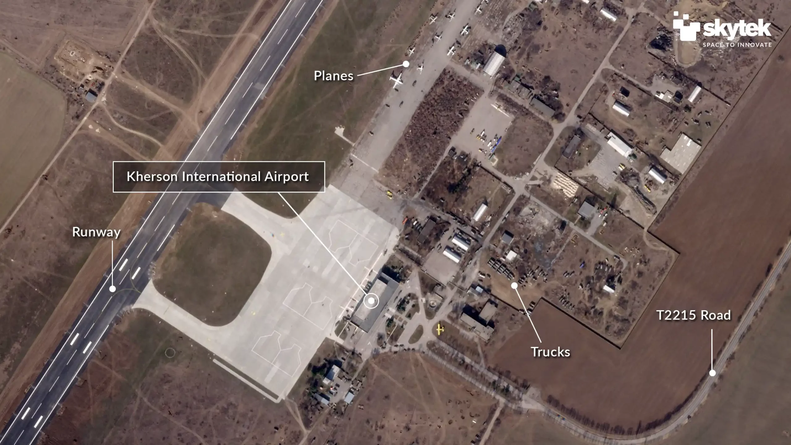
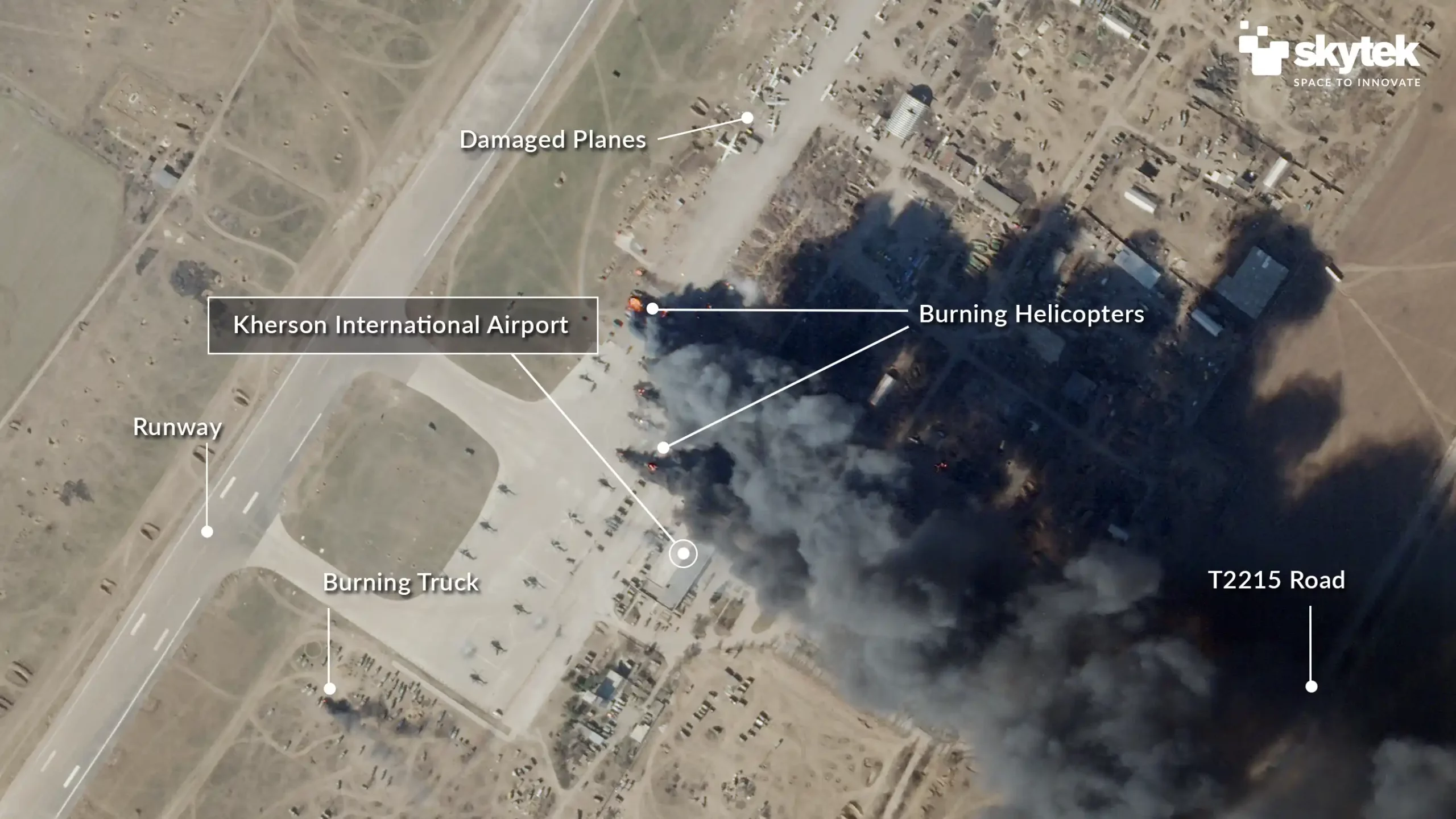
Figure 1 – Kherson International Airport on February 28th, 2022

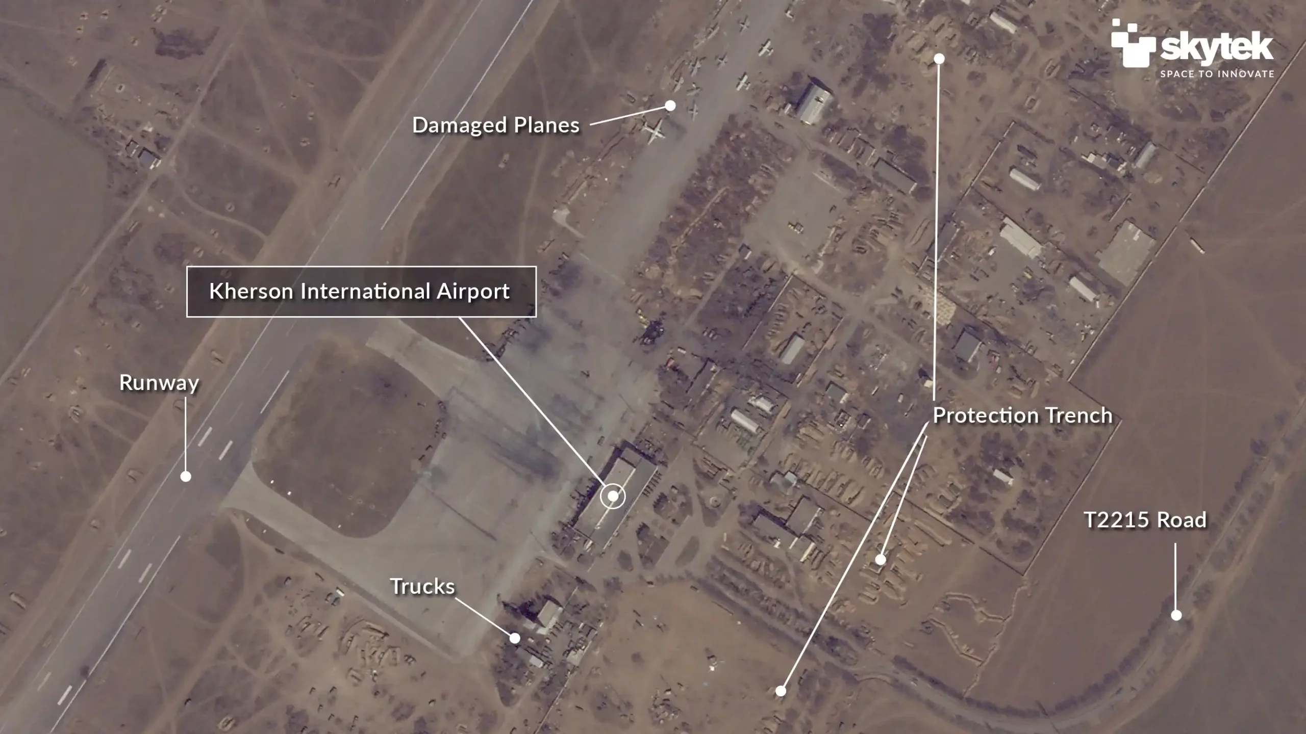
Figure 2 –  March 15th, 2022

Figure 3 – March 24th, 2022

04 / UNDERWRITING

Assess Underwriting Risks

The Satellite Club helps insurers assess risks for commercial property more accurately and make more informed underwriting decisions. Custom reports combine satellite imagery with analytics to provide a unique view of a property and its proximity to potential hazards.

GET A DEMO

Find Out How Satellite Club Can Benefit Your Organisation